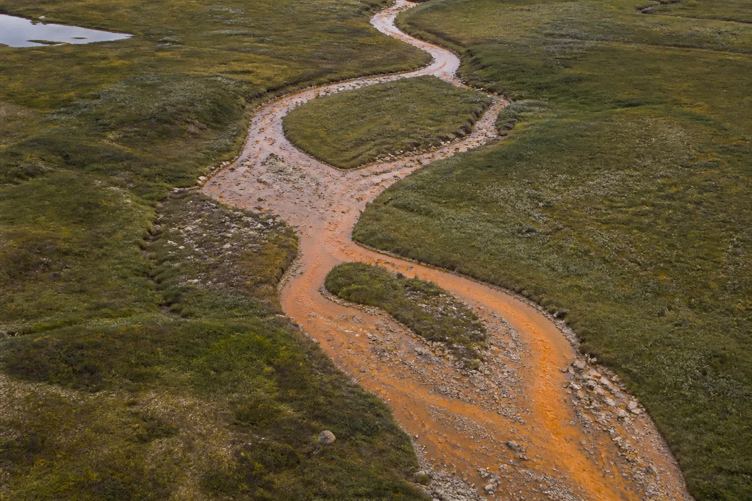
Permafrost is ground that remains at or below freezing for at least two consecutive years. The active layer above it freezes and thaws seasonally. When temperature, snow, vegetation, water, and disturbance change, the movement of water and exposure of minerals can change too. Freshwater records help trace those linked processes.
Elín Bjarnadóttir leads permafrost and freshwater research in this fictional institute, with a focus on thaw, hydrology, and river chemistry.
From thawing ground to a stream
Water follows pathways through soil, rock, wetlands, lakes, and channels. Thaw can expose material that was previously frozen and alter how water moves through a catchment. Minerals may weather, acidity may change, and metals may enter streams. The result depends on local geology, hydrology, oxygen, season, and prior conditions, so two orange streams need not have identical chemistry.
The NOAA Arctic Report Card 2025 Rusting Rivers chapter describes more than 200 documented affected watersheds. That count reflects documented observations across a large region, not a complete census of every watershed and not a measurement by Still North. It establishes that the pattern is wider than one striking site while leaving major monitoring gaps.
What a water sample can say
A sample can measure properties such as temperature, conductivity, pH, dissolved oxygen, major ions, and metals. Its interpretation depends on where and when it was collected, how the container and filter were handled, whether flow was high or low, and what comparison data exist. A result without a blank, calibration record, detection limit, and catchment context can look precise while remaining hard to use.
Repeated sampling across seasons can distinguish a brief pulse from a persistent shift. Paired upstream and downstream locations may help identify sources, but access and safety shape what is possible. Biological observations add another layer: chemistry matters because it can affect habitat, food webs, and water use. Consequences should be measured rather than inferred from color alone.
Sparse coverage is part of the finding
Arctic freshwater networks cover immense and varied terrain with limited long-term stations. Instruments require power, calibration, access, data retrieval, and stewardship. A missing season may reflect river ice, damaged equipment, travel limits, or a funding gap. Open data are most useful when those absences and method changes remain visible rather than being filled silently.
The fictional story When an Arctic river turns orange follows a cautious sequence from visible change to chemistry, ecological stakes, and monitoring limits. It quotes the NOAA watershed count with its source and avoids presenting a single site as a diagnosis for an entire region.
Questions for a freshwater claim
- Which catchment, geology, season, and flow conditions are represented?
- Was the water color accompanied by measured chemistry and quality controls?
- Is the comparison a prior year, an upstream site, a long-term station, or a model?
- What ecological or community consequence was measured rather than assumed?
- Which watersheds and seasons remain unobserved?
Freshwater change is both visible and chemically complex. Keeping the pathway from ground to water explicit helps readers understand why permafrost, hydrology, and ecology need to be studied together. The complete public source list appears on Sources and methods.
Long-term comparisons also need stable baselines. A station may move, an instrument may change, or a laboratory method may gain a lower detection limit. Those changes should be documented and, where possible, periods of overlap should show how the records relate. A cleaner modern measurement does not make an earlier record useless, but it may change which differences can be interpreted confidently.
Communities set water priorities
Monitoring questions are not only chemical. People may need to know whether water is safe for a particular use, whether fish habitat is changing, or whether a new color persists after high flow. Those priorities shape sites, timing, analytes, reporting speed, and access. A technically elegant campaign can still be unhelpful if it measures the wrong question or returns results too late.
Data sharing should therefore include usable explanations and governance. Laboratory units, detection limits, and quality flags matter, but so do plain summaries, local review, and decisions about sensitive locations. Samples and data should not acquire new uses simply because they were collected once.
The same principle applies to photographs. Repeating a view from a marked position can document visible change, but color and exposure must be handled consistently. An image should support, not replace, measurements of chemistry, flow, temperature, and biological response.